


4 years ago


Newly released satellite pictures show that during the few days before the new clash, China brought in machinery, cut a trail into a Himalayan mountainside and even dammed a river.
The images, released on Tuesday, a day after soldiers engaged in hand-to-hand combat in the freezing Galwan Valley, show an increase in activity from a week earlier.
India said 20 soldiers were killed in a premeditated attack by Chinese troops on Monday night at a time when top commanders had agreed to defuse tensions on the Line of Actual Control (LAC), or the disputed and poorly defined border between the nuclear-armed neighbours.
China rejected the allegations and blamed frontline Indian soldiers for provoking the conflict which took place at the freezing height of 14,000 feet (4,300 metres) in the western Himalayas.
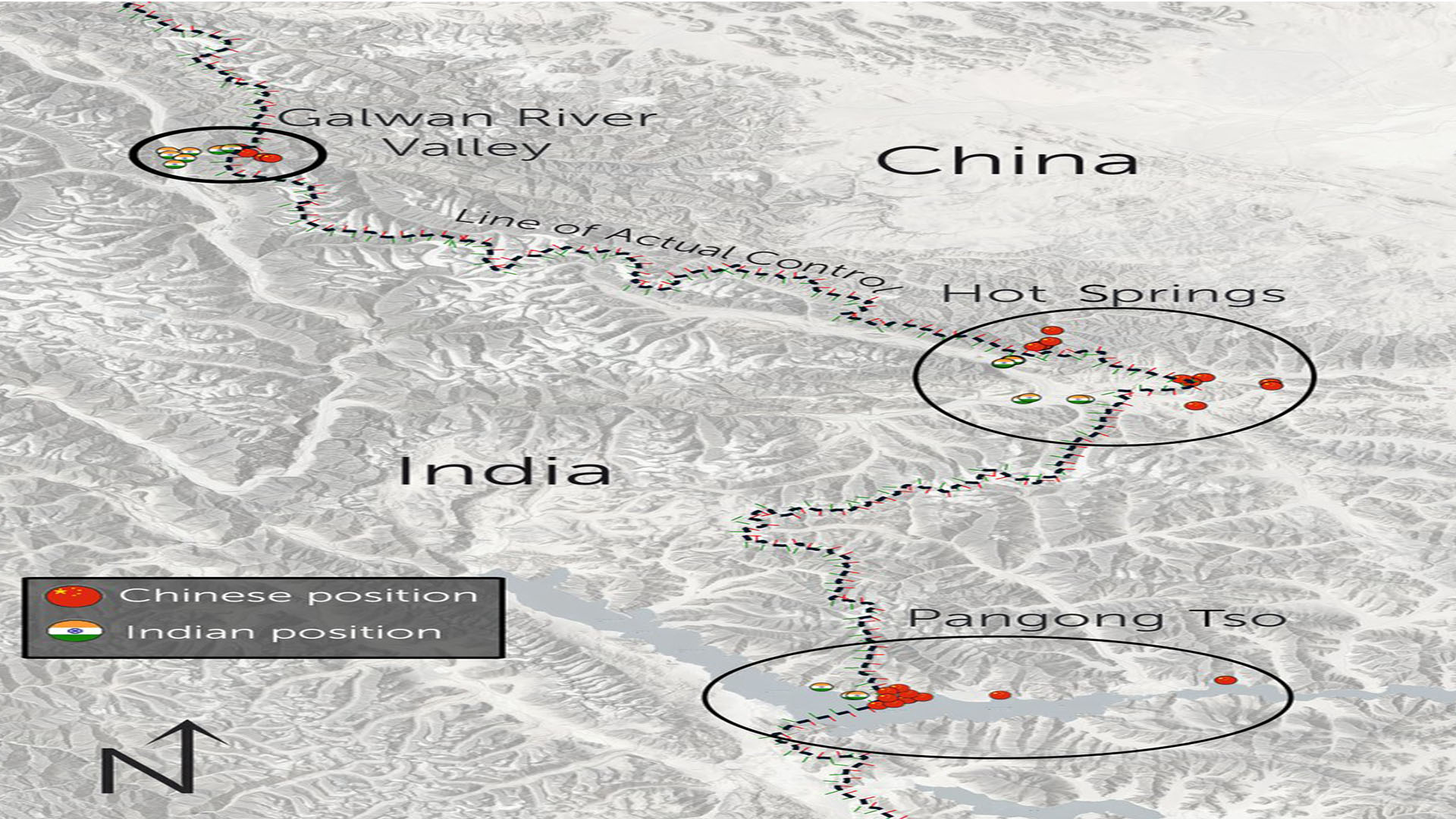
The 4,056-km (2,520-mile) border between India and China runs through glaciers, snow deserts and rivers in the west to thickly forested mountains in the east.
The Galwan Valley is an arid, inhospitable area, where some soldiers are deployed on steep ridges. It is considered important because it leads to the Aksai Chin, a disputed plateau claimed by India but controlled by China.
The satellite pictures, taken by Earth-imaging company Planet Labs and obtained by Reuters, show signs of altering the landscape of the valley through widening tracks, moving earth and making river crossings, one expert said.